From mountaintops to the deep sea in New Zealand’s Milford Sound
The Washington Post
By Erin E. Williams
September 7, 2018
We were on top of the world at the bottom of the world, encircled by a 360-degree panorama of mountain peaks. My husband and I had reached Key Summit, the pinnacle of a half-day hike in New Zealand’s Fiordland National Park. I wanted to lollygag and drink in the views, but the weather had other ideas. The temperature plummeted about 30 degrees and a blustery wind threatened to whisk us away. Andrew and I started back down the path. With bent heads, we pushed through the wind — extreme for us, but weather as usual for a Kiwi.
Key Summit is one of many hiking trails — or as locals call them, tracks — that crisscross the South Island near Milford Sound, the green gemstone atop New Zealand’s wilderness crown. Milford Sound sits within Fiordland National Park, which in turn is part of Te Wahipounamu — South West New Zealand, a UNESCO World Heritage site that covers 10 percent of the country’s landmass.
Milford Sound’s mountains, rain forests and its fjord draw more than 500,000 visitors each year. Many of them are tour bus day-trippers from neighboring Te Anau or Queenstown who take a quick boat cruise, snap photos and head back to town. A landing strip and helipad accommodate sightseers who forgo the drive and whiz in and out. One lodge is available to those who prefer to stay a little longer.
Andrew and I chose a different option: driving a rental car and pitching our tent. This provided us with maximum flexibility to experience this famous landscape without the infamous crowds — from ascending mountaintops to descending below the water’s surface to float among deep-sea creatures.
To reach Milford Sound, we departed our hostel in Te Anau, a nearby lakeside town, and hit the road: the Milford Road, or State Highway 94, which is the only land-based route. We left before sunrise to allow enough time to make our 9 a.m. Milford Sound cruise departure.
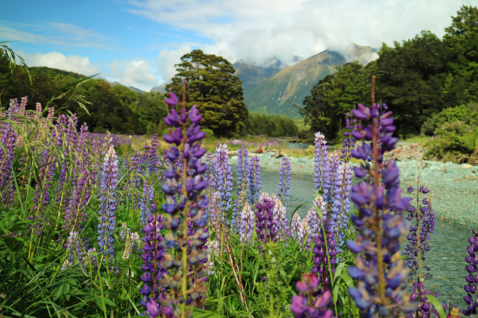
The nearly 75-mile journey stretched toward cloud-ringed mountains that glowed pink in the predawn light. Fog draped over lowland pastures, and yellow wildflowers framed the road. As we passed the Fiordland National Park entrance, the road twisted through an enchanted fairyland of red beech forests and golden grasslands draped in stalky wild lupines. The Livingstone and Earl mountain ranges loomed closer with every mile.
After many stops to gawk at the natural drama, we reached the nearly mile-long Homer Tunnel, which passes through a mountain into the Milford Sound area. Although there was no traffic, a Department of Conservation ranger in Te Anau had warned me that vehicles would be queuing later in the day.
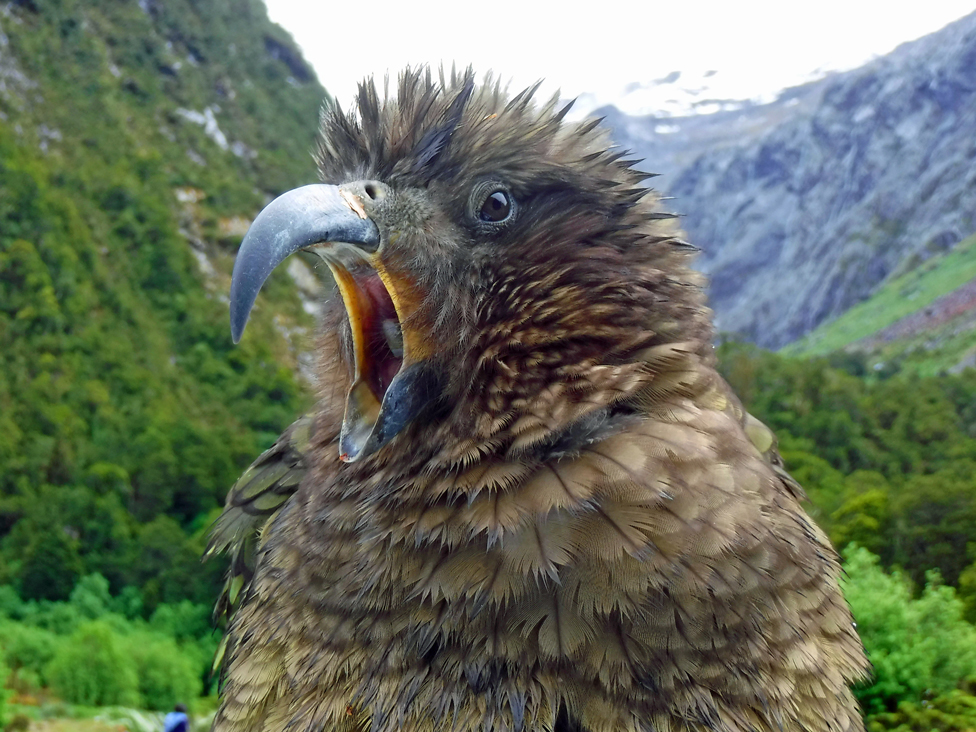
As soon as we pulled over to enjoy the view before the tunnel, a large green parrot landed on our car hood with an insouciant thump. The native kea set to work stripping the rubber from the windshield wiper, eyeing me for my reaction.
The world’s only alpine parrots are highly intelligent and seem to hang around parking lots solely to tease camera-snapping tourists and dismantle their vehicles. One tried to rip off our antenna before clumsily sliding down the back of our car on his belly. Three clung with their beaks to the top of a camper van leaving the parking lot. They rode with apparent glee down the mountain until they released together, a flash of emerald flying into the treetops.
We could have watched them clown around all day, but we were running late. My need to stop for every vista, flower and bird had turned a two-hour drive into nearly four. Tearing ourselves away from the rambunctious parrots, we drove through the Homer Tunnel and descended the mountain to Milford Sound.
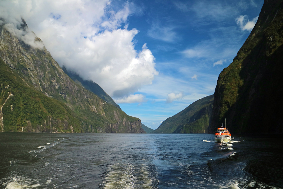
We checked in for our cruise at the bright visitor terminal and boarded the boat for the two-hour circle around the misty fjord. Milford Sound isn’t actually a sound; rather, it is one of 14 fjords in Fiordland. Ice age glaciers carved the valley, and as they receded, the Tasman Sea filled it.
Moments after the boat pulled away, Mitre Peak appeared overhead. Below, its reflection tattooed the water’s surface. At 5,522 feet, it rises directly from the fjord floor. Taller still is Mount Pembroke, which cradles the last glacier visible from the water. Granite cliffs adorned with precious jade-colored greenstone soared hundreds of feet in the air. Rain forests clung to the slopes. Waterfalls thundered into the fjord.
This early in the day, there were only a couple dozen passengers. The crew pointed out natural features and described the fjord’s Maori and European history. The boat passed Dale Point, Milford Sound’s entrance from the Tasman Sea, which eluded sailors for years. Although generations of Maori used the fjord (naming it Piopiotahi) to gather greenstone (or Pounamu) and food, European explorers only realized in the early 1800s that what appeared to be a bay was actually a gateway to the fjord.
We slowed down to pass a group of fur seals sunning themselves on rocks. I leaned over the bow to scan the water for sharks, dolphins and penguins who visit the area, but they were a no-show.
When the boat reached Harrison Cove, the fjord’s shallowest area, Andrew and I disembarked with another couple at the Milford Discovery Center and Underwater Observatory. Opened in 1995, the observatory floats on the water’s surface. Steel beams bolted to the fjord wall stabilize the structure yet allow it to rise and fall with the tide. The creators designed the structure for minimal effect on its environs, and the animals are free to come and go as they please.
A guide greeted us among rows of panels that detailed the area’s natural and cultural history. We descended 64 steps to a circle of windows that opened onto a reef, part of the Piopiotahi Marine Reserve that protects more than 2.5 square miles along the fjord’s northern side.
Outside the window, a blue cod regarded me with curiosity. Snake stars draped over black coral, and sea perch lay camouflaged on the reef. Starfish clustered in crevices, and schools of fish undulated around the observatory.
Excited, I began peppering the guide with questions. She gamely explained the factors — calm water, lack of sediment and low light conditions caused by a freshwater layer that floats atop the saltwater — that create deep water emergence, a unique marine environment that allows species that normally live hundreds of feet below the surface to flourish in the shallows.
“Do you get to know any of the individual animals?” I asked.
“Yes, although my boss warned me not to become attached to any of them,” she said. “I had a favorite cod, and a few weeks ago, another fish ate him right in front of me.”
I pressed my face to one window after another, asking rapid-fire questions. Finally, she gave me a handout.
The hour-long visit ended too quickly, and we boarded a second boat for the return.
Back on the Milford Road, we parked the car at the trailhead for the Key Summit Track. The four-mile, out-and-back hike branches from the Routeburn Track, one of New Zealand’s nine famed Great Walks that meander through some of the country’s most varied and spectacular environments.
The Routeburn section started with a gradual climb through beech forest. Sunlight flickered off green rocks decorating the trail, and moss dripped from the trees. After an hour, the Key Summit Track split from the Routeburn and climbed above the tree line. Snow-capped mountains became our trail companions. They kindly didn’t say a word about my huffing and puffing as the terrain steepened.
At the 3,000-foot summit, a nature trail curved through an alpine wetland where pools reflected gnarled trees and clouds. The Humboldt, Ailsa, Livingstone, Earl and Darran mountain ranges encircled the peak. Bright blue lakes adorned the mountains like pendants, a surprisingly spectacular payoff for such an accessible ascent.
And then the weather turned mean.
By the time we reached our campsite at Knobs Flat along the Milford Road, it was 15 hours after starting our day. I was ready to clamber into our tent for the night. The campground is a small operation in the Eglinton Valley, which cradles one of New Zealand’s most extensive lowland beech forests and more than 30 threatened plant and animal species.
The facility has six studio units, tent sites, hydro-powered amenities (a rustic hot shower, kitchen and laundry) and an unwelcome committee: sandflies. As soon as we stepped out of the car, the region’s most notorious residents began assailing us. We hurriedly pitched our tent, waving away the marauders while spindly legged, white-bellied South Island robins investigated our work.
We dashed into the campground’s shared kitchen, knocking elbows with German campers as we cooked dinner. I zipped into my sleeping bag well before the 9:30 p.m. summer sunset and fell asleep to the lullaby of sandflies hurling themselves against our tent.
The next morning, we broke camp in the rain and consulted our host about hiking the first segment of the Gertrude Saddle Route from its trailhead near the Homer Tunnel.
“Be careful,” he said. “We lose trampers out there every year.”
Given the weather and his warning, we decided to traverse only the route’s flat, boulder-strewn glacial valley and turn back before a difficult rock face made passage treacherous.
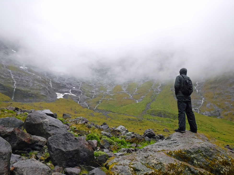
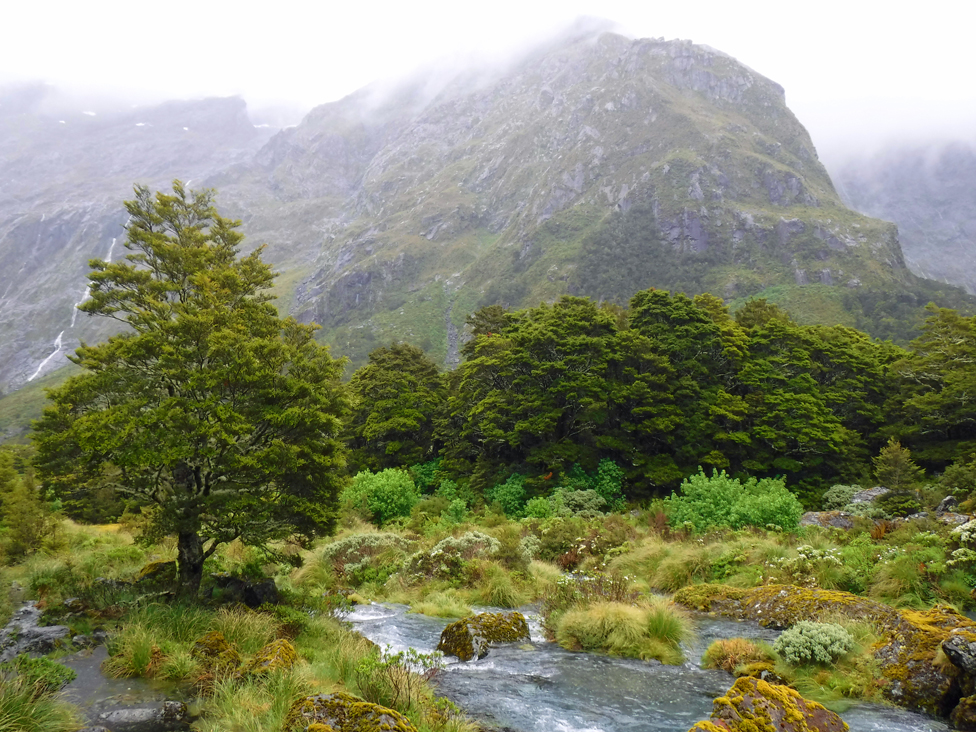
The trailhead parking lot was empty. We crossed several rain-swollen creeks and cerulean pools. Low-hanging clouds nearly obscured the waterfall-ribboned cliffs surrounding the valley.
After a couple of hiking hours, we reached the rock face. Rain and sleet pelted my gear. Milford Sound was living up to its reputation as one of the planet’s wettest places.
It was time to turn around. Andrew carefully rockhopped along the flooded trail, but I slogged along knee-deep in water, not caring whether I became any more soaked. I lowered my eyes to avoid the stinging rain and delighted in all the details — the mist, trees, boulders, moss and water — that the mountains might have overshadowed on a sunny day.
Heading back to Te Anau, we made our last stop at an easy pull-off for Cascade Creek. Alpine peaks poked from the mist, but wildflowers stole the scene. Acres of purple, pink and blue lupines fringed the rocky stream in riotous color — a final, sweet reminder of the region’s varied drama.
Original at The Washington Post.
PDF here: 2018-09-09 Milford Sound.

